Lambdafields Solutions for the Real World.
At LambdaFields, we build models that don’t just fit data—they understand it. Our core technology is a general-purpose framework for probabilistic inference in spatiotemporal fields. It’s grounded in physics, designed for uncertainty, and built to adapt across domains.
Magnetic Resonance Imaging (MRI)
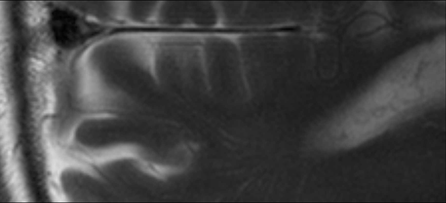
The Challenge: Slow Scans and Compromised Quality
Our Solution: Maximizing Information, Minimizing Time
At LambdaFields, we’ve developed a new class of reconstruction algorithms, inspired by astrophysical methods for imaging faint, distant galaxies. Our technology addresses the core challenge of MRI by extracting every single bit of useful information from raw, undersampled data. Unlike traditional methods that rely on extensive training data, our approach is mathematically sound and training-data-independent. This means it works straight out of the box, delivering high-quality images with significantly less data, and in a fraction of the time. The result is a paradigm shift: faster scans that don’t just maintain, but actually improve image quality, providing sharper resolution, reduced noise, and more detailed tissue structures.
Keyfeatures of accelerated MRI
-
1Maximum Information Yield:
Our technology extracts every last piece of signal from your raw data, revealing fine details and structures often lost in standard reconstructions.
-
2No Training Required:
Unlike data-driven AI, our approach requires no training data, making it instantly deployable and robust against bias.
-
3Built-in Uncertainty Quantification:
We provide a quantifiable measure of diagnostic confidence for every image region, a crucial tool for clinical decision-making.
-
4Regulatory-Friendly Transparency:
Let’s talk!
Sharper images from noisy scans.
We’re developing high-resolution images from noisy MRI raw data by fusing advanced reconstruction algorithms, intelligent noise reduction, and uncertainty quantification. Our probabilistic models help radiologists understand what they are seeing, providing a clear picture of tissue structures—complete with uncertainty estimates for clinicians who need to trust what they see.
Questions? Contact us!
Urban Airfield
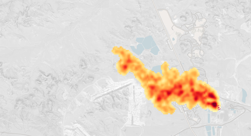
Reconstructing dynamic and accurate pollution fields that cities can actually use.
Air quality in cities shifts constantly, driven by traffic, weather, and complex atmospheric processes. But most monitoring systems still rely on sparse stations, drifting low-cost sensors, and black-box models that don’t explain themselves. The result? Patchy data, vague maps, and decisions made without knowing what’s really there—or how sure we are.
What we do – a new way to look at Air Quality
We fuse satellite data, ground sensors, and meteorological fields into dynamic, high-resolution air quality maps. Our models self-calibrate low-cost sensors in real time, correct for drift and noise, and estimate uncertainty at every point. That means no hand-tuning, no guesswork—just decision-ready insights about what’s in the air, where it’s moving, and how much you can trust the numbers. Whether you’re working in city planning, health policy, or field campaigns, we help turn raw measurements into actionable maps.
No city is the same—and no sensor network is perfect. Our inference platform adapts to your setup, whether you’re working with dense arrays, drifting devices, or just patchy coverage. Let’s make sense of your data, your way.
Keyfeatures of our Air Fields
-
1Sensor Self-Calibration:
Automatic bias and drift correction built into the model.
-
2Spatiotemporal Resolution:
Street-level maps of pollutants like NO₂, PM₂.₅, and O₃
-
3Uncertainty Estimates:
Every prediction comes with a confidence score.
-
4Multimodal Data Fusion:
Integrates EO, weather, traffic, and in-situ data.
-
5Operational Diagnostics:
Sensor health, data gaps, and anomaly detection in real time.
Spacefield Reconstruction
The Challenge: Imaging the Unseeable in a Sea of Noise
Our Solution: A New View of the Cosmos
Inspired by the same mathematical principles used to solve similar problems in magnetic resonance imaging, we’ve developed a novel imaging algorithm specifically for VLBI. Our approach treats the imaging task as a Bayesian inference problem, which allows us to effectively reconstruct a time-varying, spectrally-resolved image from scarce data. Instead of relying on traditional methods that struggle with low signal-to-noise, our algorithm exploits the underlying correlation structures in time, enabling us to piece together a coherent “movie” of dynamic astrophysical objects. This method not only reconstructs the primary emission ring but can also reveal fainter, time-variable structures outside of it. The result is a richer, more detailed understanding of phenomena under extreme conditions, such as general relativity and magnetohydrodynamics.
Key Features of Spacefield imaging
-
1High-Quality Dynamic Imaging:
Our technology excels at reconstructing time-varying “movies” of dynamic astrophysical objects, capturing rapid changes even with sparse data.
-
2No Training, (almost) no Assumptions:
Unlike many data-driven methods, our algorithm doesn’t require pre-existing data models, making it robust and unbiased for observing new, unexpected phenomena.
-
3Uncertainty Quantification:
We provide an explicit measure of uncertainty for every part of the reconstructed image, giving astronomers confidence in their findings.
-
4Robust Against Scarcity: